

| 210 Miles long | Official Guide Available |
 | |
| Welsh Sections | |
| Shropshire Sections | |
| Worcestershire Sections |
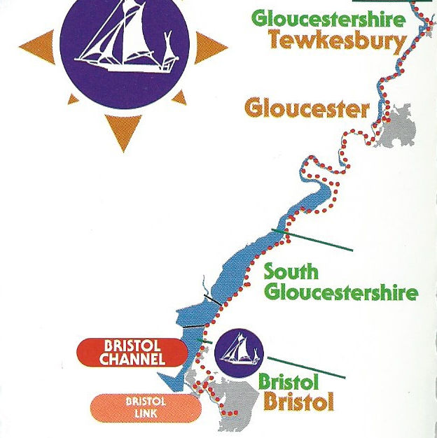
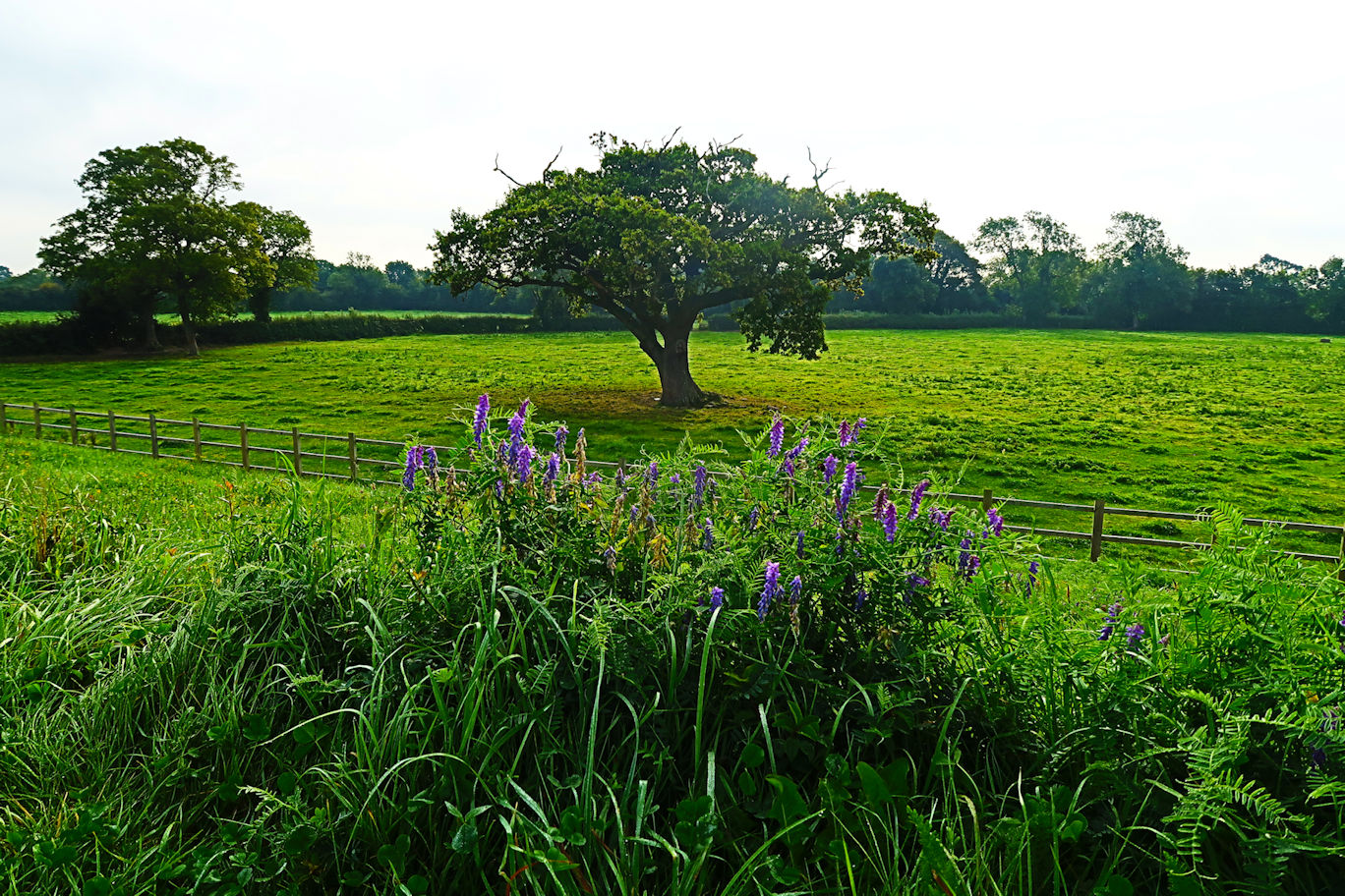
At Upton we once again cross the river and head out onto the Ham, another flood plane and follow fields to pass underneath the M50 Motorway and passing close to Bredon School; a very expensive Private School in its own huge grounds. Pushing on, pass into Gloucestershire and reach Tewkesbury, an old market town where we pop out at the Mythe Bridge and walk to the top end of the town where we fool around with the River Avon for a short distance where its 88 mile journey from Northamptonshire comes to an abrupt end, feeding as it does, into the Severn. From here we pass by the ancient battle grounds of the Wars of the Roses where a decisive battle was fought and won by the King and re-enacted each year with hundreds coming to join in and hundreds watching the spectacle.
Once again we are passing through many fields heading down to Deerhurst where we find Oddas Chapel which was built about a thousand years ago and well worth the slight detour to visit. From here we pass an excellent pub called the Coal House and press on to the Haw Bridge where we are spoilt for choice with two pubs on the far bank. The path stays on the same side here so there is no excuse to cross to the other side for a beer and our mileage hardly warrants it! Another pub; the Red Lion' soon hoves into view, this time on our side - will the torture never end! It is here that we have a little climbing to do ascending Wainlode Hill, but it is short lived and we are soon back down to river level again with Gloucester in our sights a few miles distant and the end of the day.
Aiming for the Docks, the Severn Way can be picked up just by the prison. Walking forwards towards the docks, which have now been transformed into private apartments, shops, cinema and various trendy bars, we cross at the first set of locks, the Way is soon back on the road which is followed to the end then a right and a left onto the busy main road. On the left is the Llanthony Secunda Priory remains, which is remarkably quiet in the grounds and well worth the slight detour. Rejoining the route which now crosses the road and heads down through the industrial estate soon leaving the hustle and bustle and into the countryside meeting up with the river.
We are now following the river which eventually pops out at Lower Rea - be careful to avoid the farm (Lower Rea Farm) by going to the left and through a gate. Some road work eventually leads back onto grass and the river again.
Some monotonous walking follows, made slightly more interesting by the view of Minsterworth Church on the other side of the river which makes a nice photo opportunity. Later on the A48 comes close to the river on the other bank - the main road down to the Forest of Dean. Epney and the 'Anchor Inn' provide an irresistible welcome break for coffee. From here, yet more road work. It is worth pointing out that, even though it is an almost irresitible temptation to return to the river at this point, it will only end in disappointment as there is a small tributary alongside Upper Framilode that halts progress requiring a return to the entrance gate. Not that I would be foolish enough to try that...
Yet more road to Priding. Look out for the crests on the houses, they are quite ornate, as is the local church. Pressing on, finally some change of scenery with a walk through a small woodland brings us out onto the large loop. At this point we are less than two miles from our destination directly, but need to walk nine miles to get there!
The first bend in the river can be seen all the way but never seems to close but then we are round it and can see in the distance, the 'Old Passage Inn' which marks just over half way and provides a good view of Newnham with the church on the hill.
Continuing the curve, we finally hit the home straight through various fields, noticing the 'Arlingham Project' looping walks. These are four walks centreing on Arlingham itself and denotes by different creatures; fish, bird, cow etc and divide up the section of land enclosed on three sides by the river. A slight uphill into some more woods again provides some variety in a otherwise uninteresting walk.
At the other end, views across the sandbanks of the river are interesting and one cannot help but wonder what would happen if one tried to walk across! From here the Way leaves the river, although unsigned, is obvious. Heading past a large house, eventually the road is reached. Turn right and follow it in over the Canal to Frampton and the very welcome 'Bell Inn' and the end of the walk.
Actually this section should be named Oldbury to Frampton as that was the way I did it, but for consistency it's named North to South. Starting at Oldbury has a minor logistical problem in that it is hard to reach - luckily my trusty chauffeur was on hand for an early drop-off. Walking through the small village at 7:30am was nice and very quiet, although I suspect this village never truly awakens.
I eventually arrived at the small shop and local pub (The Anchor) where I picked up the way at the side of a small inlet which I followed to the River, stretching more than a mile to the bank on the far side. Turn right and head upstream towards the Power Station. Not a pretty sight it must be said and one I was pleased to be past and onwards. In the far distance I fancied I could see Berkley Power Station some three miles distant - actually it turned out to be Sharpness Docks several miles further on. Berkley has worked hard to provide a nice route around the station and it is hardly visible once the river is temporarily departed. Crossing the main entrance road, the route is sketchy and assumed it was straight on but it quickly deteriorates in quality and navicability, but ultimately allows the inlet stream to be crossed and the river rejoined.
Next stop is Sharpness Docks which are altogether a different story. The end of the river section arrives abruptly with gates and whilst pleasant gives no indication of the route. I tried several options, all of which were fruitless and finally resigned myself to following the road around the outskirts of the Docks, which were quite ugly from this viewpoint. The road curves left which I assumed to be correct as it must eventually come back to the river and the Sharpness-Gloucester canal. Indeed it did with a helpful, but rather late signpost. I guess if one were walking in reverse it would be more obvious. Walking up past the Dockers Clubhouse the route turns down a small lane to a car park with again no signage - down to the right into the Marina and around onto the main path that follows the canal.
It was here that I elected to have lunch so chose a likely spot and sat down to enjoy the canal, birds and the occasional boat. Collecting my belongings I set off to the old river bridge which was the subject of a major disaster with two oil tankers colliding into it and exploding, destroying the bridge beyond economical repair. Note for the future - on the far side is a nice bench!
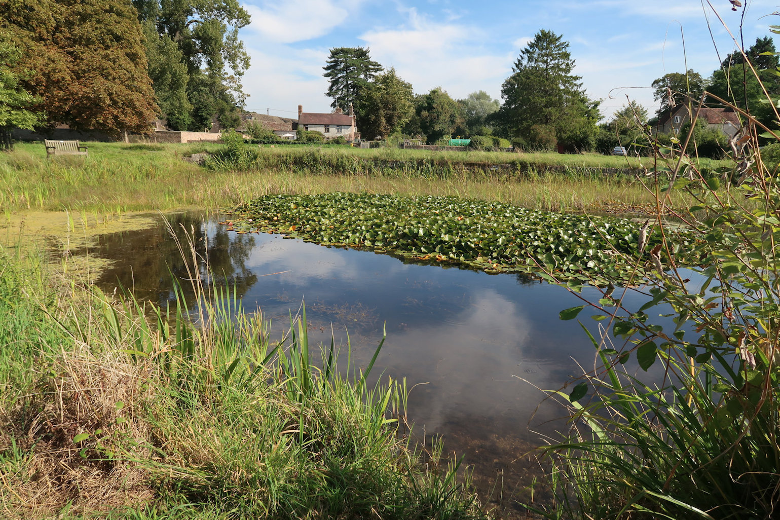
From here it is a long slog along the canal, punctuated at Purton by a 'ships graveyard' which was interesting. A number of ships, probably 20-25 were put here to assist with erosion control, now long since rotted, but some still look like ships, others have a small section or two exposed but overgrown with grasses and flowers - exactly the purpose so I guess it worked.
Onwards to the Slimbridge bridge which as always was busy with traffic to and from the Wildfowl centre just down the road. A couple more bridges and the final crossing at Frampton Church led me into the village and to the far end and my pick up point; the Bell Inn. News to me was that there is a cafe, shop and pub at the Southern End of the village, all of which had to be ignored for my final destination.
As before, my trusty chauffeur dropped me on the outskirts of Oldbury On Severn. This time I would be heading South to the end of the Severn Way. Walking out to the river I couldn't help noticing an ominous cloud moving towards the rivers edge on the far side. Suspecting it was, at least rain, and possibly snow I considered donning waterproofs but decided to delay a while to see what transpired. I didn't have to wait long! I was wearing my Rab Kinetic Jacket which is waterproof for a while but I knew soon I would have to get the shell out. As I approached a gate, it seemed like the ideal time.
The rain came down, steady at first, just enough to let me know it was there, but as I approached the Northern Severn Bridge, most notable for the short but steep climb to reach the viewpoint, which under any other conditions would warrant a stop and maybe a photo or two, but the rain turned to snow, coming heavier combined with a distinct drop in temperature and increase in wind speed. Across the footbridge which spans the M48 the route heads down to a T-Junction. No obvious signposts, so I stopped to extract the guide from my pack. Right turn and follow the road through Old Passage and back down towards the river. Some road work followed across the wetland area then a right turn (not the obvious gate!) following an embankment bought me to the outskirts of Severn Beach where the snow/rain subsided and the sun came out. Pausing to remove my waterproofs I continued on and under the second Severn Bridge, this one carrying the M4, and walked along a good tarmac path, passing Severn Beach village which, back in the day was a holiday resort but no longer so popular.
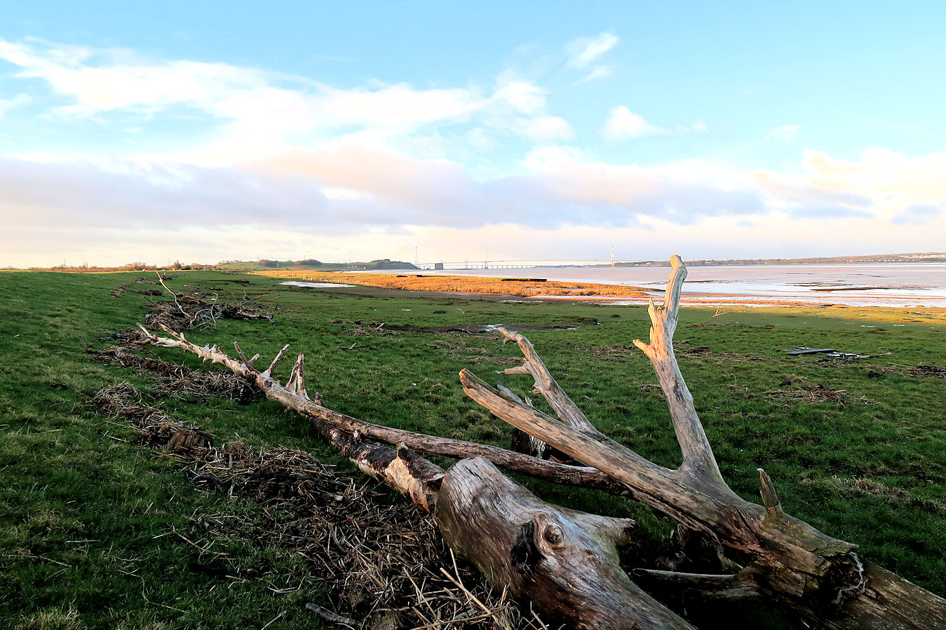
Officially this is the end of the Severn Way, but the signposts continue, now showing 'Bristol Link' which continues another 14 miles into the centre of Bristol. Initially a good tarmac path (if that's not an oxymoron!), it soon disappears into a woodland, still good walking but then emerges onto the A403 for a while before back into a wooded area, the road and railway line being on the left and right respectively. This continues until it pops out at the edge of a huge Industrial Estate. With the corresponding traffic I couldn't help thinking how depressing it would be if I'd walked the entire 200+ mile walk travelling through some beautiful countryside only to reach this as the conclusion. There is some mild confusion here. The guide suggests first left at the roundabout onto Lawrence Weston Rd. The directions are correct, but the road name in incorrect, it is in fact, Poplar Way West which is followed until the next roundabout where a right and almost immediate left is required. This road is now the Lawrence Weston Rd and much nicer, being a narrow country lane and very pretty if the industrial buildings are ignored, and the debris in the small rhine is also ignored!
It was getting close to lunchtime so I decided the next likely stopping point would do which turned out to be just prior to the tunnel under the M49, so I had Motorway in front of me, industrial buildings on my left and huge wind turbines on the other. No, this wasn't the prettiest place for lunch but I'd walked about 13 miles pretty much non-stop, I'd been going 4 1/2 hours and I was hungry! I ate my lunch, had some hot blackcurrant and left as soon as I could and headed onwards. Lawrence Weston itself is a suburb of Bristol and does nothing to lift the spirits. I passed a bus stop and seriously considered abandoning and catching a bus into the centre but decided that I would press on with the hope that it improved!
I was rewarded a little with some nice woodland and a field of horses, but clearly the route has changed since the guide was written, being well signposted but not corresponding to the description and I emerged onto a road with no obvious onward route marked. The guide suggested the wood directly ahead but as the previous half mile or so had not corresponded I figured it was coincidence that it looked similar to the description but knew I was heading in the right direction so continued. As it turned out, it was in the Blaise Castle Estate and very pleasant woodland walking. I checked with my mobile phone and plotted myself a route through the woodland and down to Sea Mills where I would pick up the main link again, arguing that I was heading into Bristol and technically now only walking the 'Link' so a slight detour wouldn't hurt. Soon enough I was through the road walking and back in a large park which I followed down to Sea Mills Railway Station where I picked up the river and the official Link route again. Actually I think my route choice was at least as nice as the official route.
More very pleasant walking along the river through the Avon Gorge Nature Reserve which came to an abrupt halt onto the Portway which was then a very depressing couple of miles into Bristol, made slightly less painful by the rock outcrops on one side and the view of the Clifton Suspension Bridge which seemed to take an age to appear, then another age to arrive at. From here the route soon leaves the road and becomes a nice walk along the river into the centre of Bristol, the SS Great Britain on the opposite Bank, the M-Shed, a steam railway and a pleasant environment I finally arrived at the finish, some 21 miles from Oldbury.
Not wanting to stop, I continued for another mile or so to the Railway Station where my walking for the day ended and my ride home would appear.
