
I decided to do this section in reverse, picking it up where I left it last time at the A5 just South of Shrewsbury. Dropping down to the river from the bridge is not for the faint hearted as it is quite steep but short enough that a fall would just be embarrassing rather than painful. Turning left I followed the river through pleasant quiet fields until the railway crossing which featured a very nice bridge, well worthy of photographing.
The river meanders here as it approaches Shrewsbury passing under the A49 twice. The official path crosses the river via a footbridge in the town, but prior to that leaves the river to take the walker along a road before turning back down again. The earlier bridge just before a large field which has steps on the Shrewsbury side would make a better route in my opinion as it more closely follows the river and avoids road walking altogether, although having not done it, I can't guarantee that it would work, although given the number of dog walkers and cyclists, I would be amazed if it were not possible. Either way, I found myself following the main town side of the river heading towards the 'English Bridge', a 300 year old bridge in the centre. Several more bridges, plus a very nice field are passed before recrossing at the small suspension bridge called Port Hill Bridge, which is by 'The Boathouse Inn' and a very tempting coffee bar and then a short road walk, which soon returns to the river, finally brings the walker to the 'Welsh Bridge'. It is in England still, but closer to Wales than the English Bridge which may be how it got it's name, the guide gives no explanation nor does a quick 'Google' search.

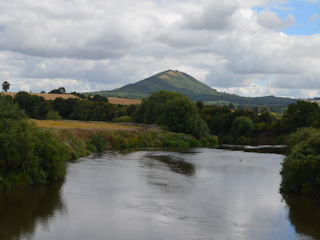
Leaving Shrewsbury takes some doing as the river takes a huge loop around before heading out. Interest is maintained with views of Shrewsbury, which if time permits, is well worth exploring. The walk is also kept interesting with history boards detailing ancient Shrewsbury. Finally the town is left, but not before passing below 'The Mount' which is famous for being the home of Charles Darwin. Not long after this, the Way leaves the river for some miles avoiding an 8 mile loop. It is reasonably well signposted, initially following a woodland access road which needs to be followed to the main road. Turn right here and then next right which leaves the road again to follow another green lane. I did manage to make a slight navigational error around Bicton where signs for the Severn Way vanish but footpath sign were still in evidence! I think my detour was less than a mile so no real hard done and I soon picked up the Way again just out of Bicton. Finally Montford Bridge comes into view which signals yet another crossing and some more road walking into Montford, crossing the A5 again via the road bridge.
From Montford, Shrawardine is reached by green lanes which are pleasant and easy going. At Shrawardine it becomes a tarmac road slog up to Wilcott but this signalled the end of my days walking so I was pleased to see the car arriving to whisk me back home for a well earned shower, beer and dinner.
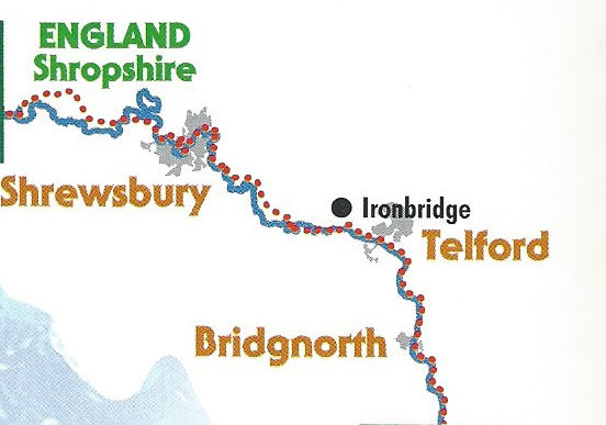
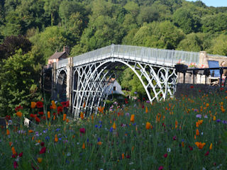
This section starts in the historic town of Ironbridge near Telford in Shropshire, named, of course, after the bridge, which, not surprisingly, is made of iron and shows off the results of the Industrial Revolution which started out in this very valley in this very town, in fact, the town of Ironbridge is a living museum dedicated to the life and work of Abraham Darby, the father of modern times.
For this section, I had decided to walk 'against the grain' and head North. The guide is written on the assumption that the walker heads from the source of the river towards its end in the Bristol Channel. Leaving the town I passed under the railway bridge where I saw a number of photographers - apparently a brightly painted train was expected from the power station any moment. I decided to wait with the enthusiastic 'spotters' and was soon rewarded with a rainbow coloured engine - an Eastern Region 'Bo-bo' if my aging memory served me correctly from a lifetime ago when I too, was a spotter.

The excitement passed I headed off in the direction of Buildwas Abbey some two to three miles distant. The Abbey is owned by the English Heritage and dates back to the 12th Century. The way passes close by before heading off to Sheinton via tracks and woodland before emerging onto a tarmac road which is followed to Cressage where it crosses the river again and heads through fields, including a National Hunt Racecourse but loses sight of the river! Finally at Atcham after some more road walking it returns to view.
Even more road walking along a busy road before finally leaving to rejoin the river. My days walk ended at the A5 bridge where I climbed up to walk the short distance to the roundabout and my ride home.
Heading South out of Ironbridge, this time on the right hand side of the river i.e. the river is on the left, the way follows what is presumably an old railway line as it is straight and flat - a dead give-away. Periodically on the other side of the river, smelting and other iron works appear which brings a true sense of history to the walk. The level crossing is, apparently, the widest in Britain which is pretty exciting I reckon.
The way follows the river closely at this stage and is pleasant walking on a good trail, in fact it would make a nice cycling trail as testament to this are the many cyclists enjoying the riding which of course has no hills to worry about so is easy going. The route of course is easy to follow - keep the river on the left! Bridgnorth appears after 9 miles which provides a welcome stop and some shelter from the rain shower currently being enjoyed. The small town has plenty of refreshment opportunities including cafes and pubs - one of the best being at the antique centre.
Out of the town, which amongst other things is at one end of the Severn Valley railway the route neatly divides the river on one side and the railway line on the other. A frequent service means that there are many opportunities for photos of steam trains taking passengers back and forth from Bridgnorth to Kidderminster.
More in evidence now are the many caravan parks, encountered on both sides of the river, providing, one assumes, 'get aways', although the occupants must enjoy steam railways otherwise it could quickly become a very tiresome place to stay. The small village of Hampton hoves into view with its caravan park and pub and it takes a good amount of willpower to walk through.
Stanley is the next village with civilisation and the end of the days walk. Highley is a mile or so out of the valley uphill of course and actually the first proper hill of the day. There is a single pub in the village which provides a good resting point and meeting place for my ride home.


