
| July 2023 |
| Bullman Hills (610m) |
| Long Man Hill (658m) |
| Round Hill (686m) |
| Bellbeaver Rigg (620m) |
| Viewing Hill (649m) |
| Melmerby Fell (709m) |
| Fiends Fell (634m) |
| February 2024 Day 1 |
| Bink Moss (619m) |
| February 2024 Day 2 |
| Dufton Pike (481m) |
| Backstone Edge (699m) |
| Meldon Hill (767m) |
| February 2024 Day 3 |
| Murton Fell (675m) |
| Long Fell (623m) |
| Tinside Rigg (624m) |
| May 2024 |
| Mickle Fell (788m) |
| Little Fell (745m) |
Peaks climbed : Bullman Hills (610m), Long Man Hill (658m), Round Hill (686m)
Total Distance : 22km, Total Ascent : 802m
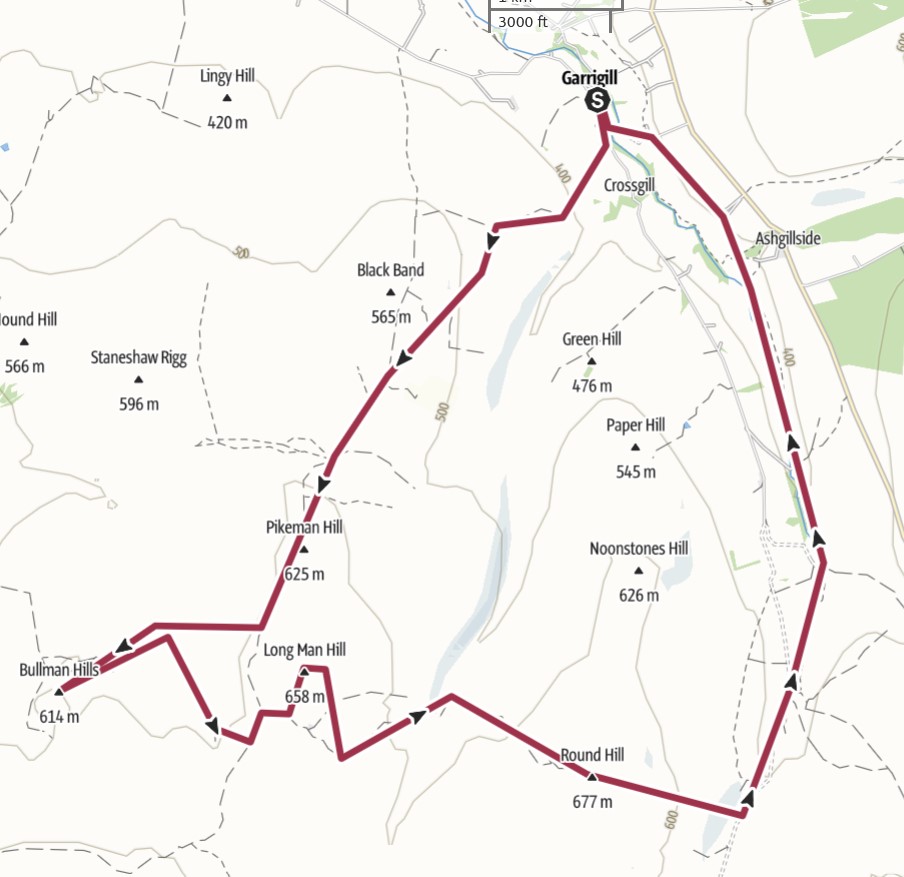
Other than when I walked the Pennine Way almost 100 years ago, this was my first visit to the Cross Fell area and I must admit, it wasn't too unpleasant, although I guess the fine weather helped with my enjoyment.
It was a walk of two halves, or so it seemed. The first half was the mountains themselves and the second half, the return to the car. The third mountain was, I think, about half of the distance.
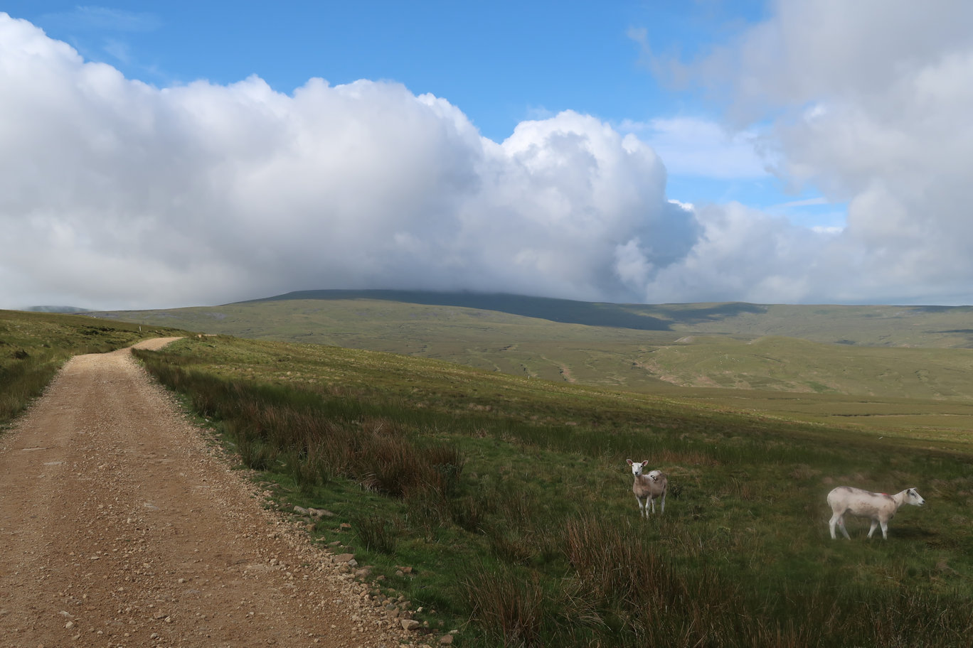
I parked in the small village of Garrigil and followed the Pennine Way out in a Southerly direction, taking a corner off on the way up to the ridge, mostly because I could! Along the ridge I could see the Bullman Hills, although they were dwarfed by Cross Fell behind them. They are odd mountains, more like small hills and barely seemed to qualify as peaks in their own right, but they did. The walk over from the main track was on tussocky heather but not as bad as previous days so I was quickly over and standing on the summit.
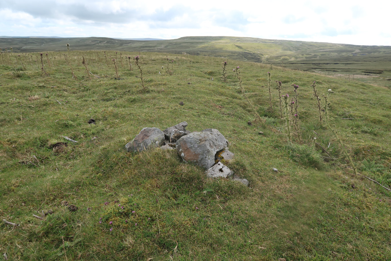
From the summit, I retraced my steps down a short track and turned right to follow the stream up to another mining track which led back to the main Pennine Way route. Here I turned left for a short while before picking up another good track which gained height although not directly towards the summit of Long Man Hill, it did crest about 30 metres of altitude lower than the summit. I was then able to follow a fence for a while on a small but good track before finally turning off to complete the ascent. The summit is a small pile of stones, but I spied another pile and whilst I was convinced it was no higher, had to visit. It wasn't!
More cross country led me down to a track which I followed down, across a stream and up the other side on a man-made track. This led to a wall quite close to the summit. I needed to follow the wall and having looked at the map, the actual summit of Round Hill was on the far side of a three-way wall. I had to climb one! Walking up, there was no crossing point so I had to employ my dry-wall climbing skills but as I was on the wall, I realised that one of the others was actually a wire fence! Oh well, I was soon over and onto another tiny summit.
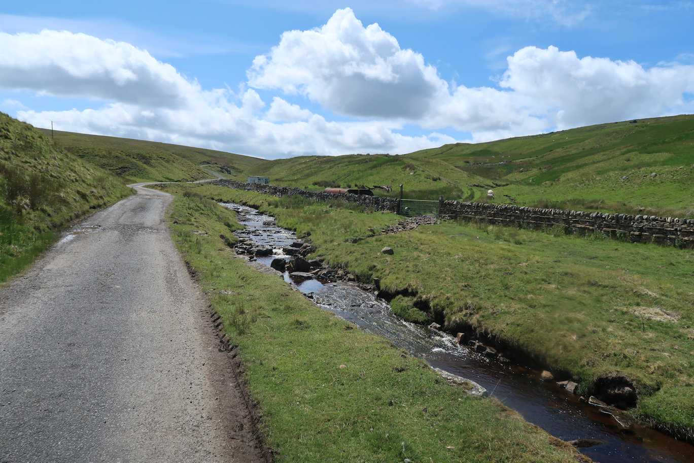
It was steadily downhill from here, picking up a good mining track I soon reached the tarmac road at the bottom. The sun was shining and the valley blocked the wind so it was an ideal time for lunch. That done, I headed off on a good single-track road which was actually part of the South Tyne Way. I decided I would follow it as it soon left the road and headed into fields and meadows and was far easier on the legs and feet. Clearly it is not the most popular walk as the path was indistinct in places. At one point it left the river behind and headed up to a ridge, following that for a while via the smallest and thinnest stiles I have ever seen, eventually after what seemed like a longer distance than the walk out to the mountains, I eventually arrived in Garrigil again, the day done.
Peaks climbed : Bellbeaver Rigg (620m), Viewing Hill (649m)
Total Distance : 9km, Total Ascent : 249m
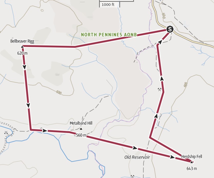
There is a tiny parking area on the main road (B6277) at exactly the right spot for a walk over to Bellbeaver Rigg. The country here is tussocky, soft, boggy and pathless so distance is no indicator of effort required. I could see the summit right from the start but I'm never sure whether that is a good thing or a bad thing, the summit never seems to arrive, as it is with Bellbeaver. I persevered and came to a fence which experience has taught me, generally has better ground and this was no different. It also led me in the right direction for the summit which, by now had disappeared over the horizon.
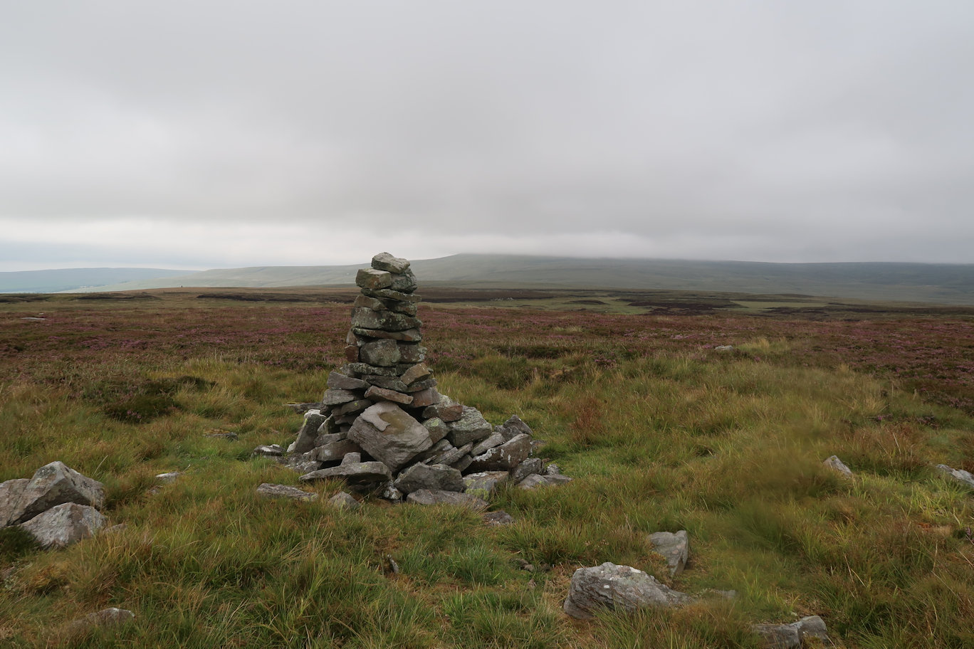
Soon enough I was on it, the views were good, but the summit itself nothing more than a small pile of stones. I was soon away over more pathless terrain, aiming for my next summit, but to get to it, I'd planned a dog-leg to use a track to bring me closer. Whether it was actually worth the effort I'm not sure really, but the day, whilst dull and overcast, was pleasant enough and I was enjoying the walking.
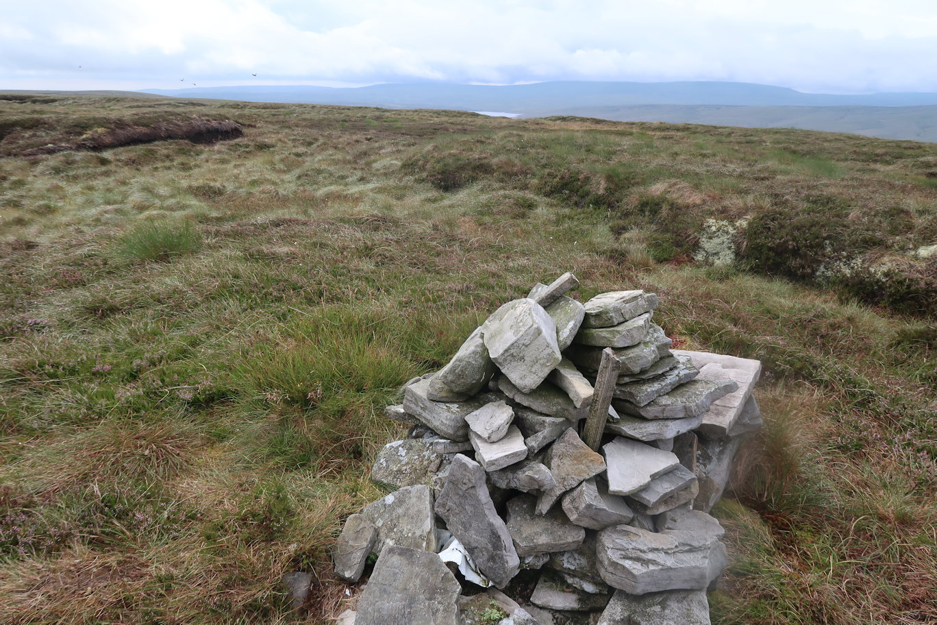
Climbing slightly I came to a good track, but my way was perpendicular to it so crossed and continued. Viewing Hill summit takes an age to get to, again over pathless boggy ground for very little in the way of a reward other than the summit.
Pausing long enough for a few photos, I more or less retraced my steps back to the good track which I was able to follow all the way back to the car.
Peaks climbed : Melmerby Fell (709m), Fiends Fell (634m)
Total Distance : 14.5km, Total Ascent : 517m
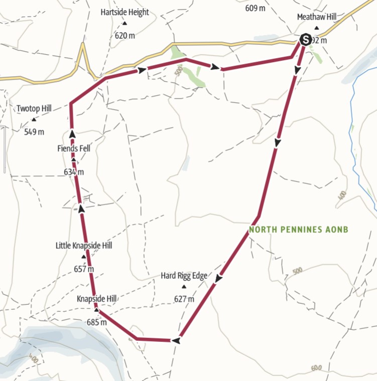
I parked a few metres down from the start of the Maiden Way which followed a good wide track for a couple of miles until the track turned left and the path continued dead ahead on a thinner but still good path. Near the summit, the path avoids it, so it is necessary to take a direct heading up. Of course this requires a decision to be made on the best time and place to do this. I saw what I thought was a good way up, so veered off and headed up. Melmerby Fell takes some patience, it rolls for what seems like an age, with the stone summit cairn never seeming to arrive, but arrive it does, eventually. There are fine views all round so, despite the effort, it is a worthwhile ascent. I decided lunchtime was appropriate so sat and enjoyed the views, the solitude and my lunch. A fine reward indeed.
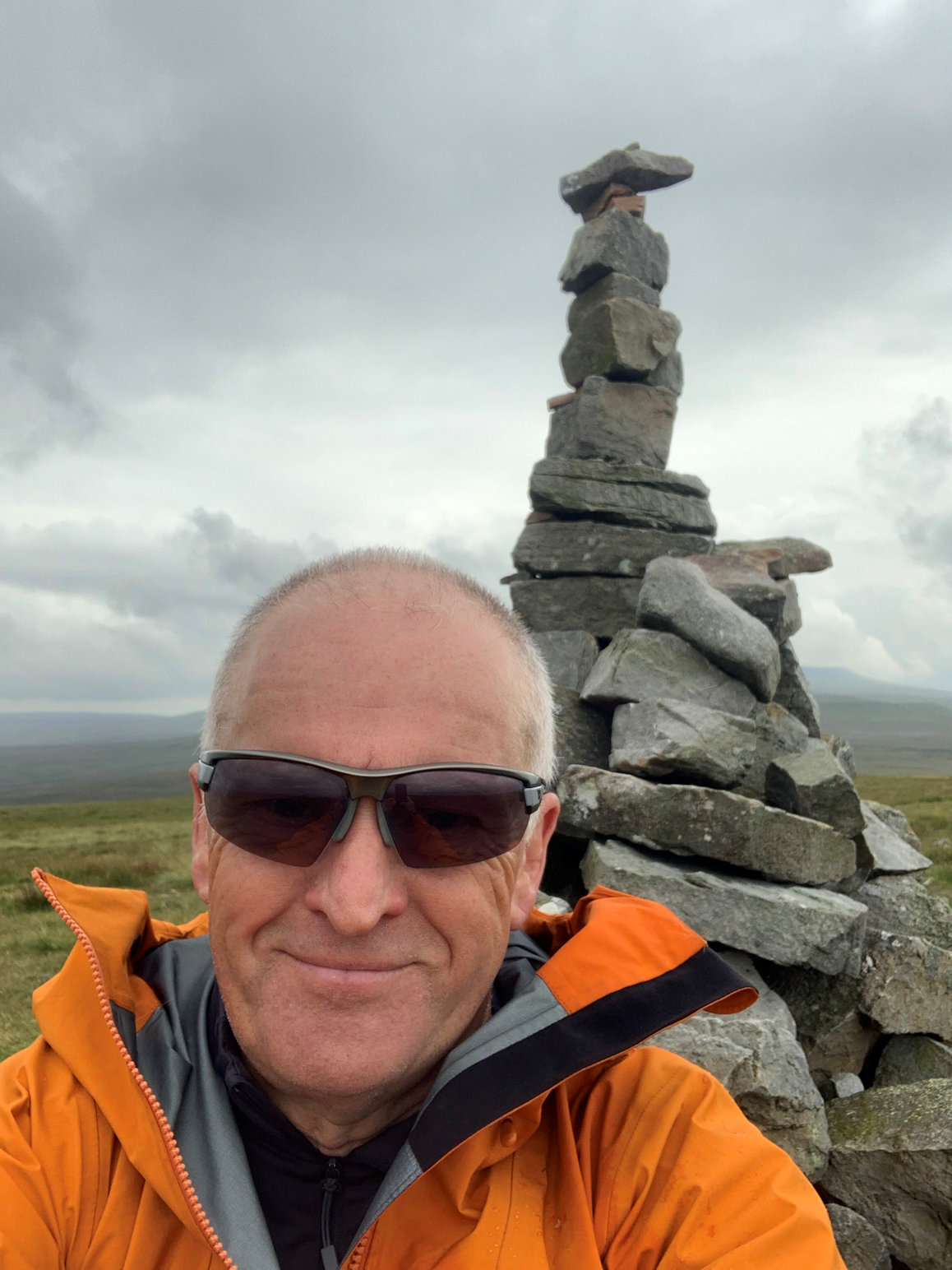
Eventually I had to make a move, so set off in a Northerly direction. Fiends Fell was directly ahead with a couple of small hills in the way, soon dispatched. The path was also good and I was quickly on the second summit. The weather had been distinctly variable all day and I was in full waterproofs so decided to continue with barely a pause for a quick photo.
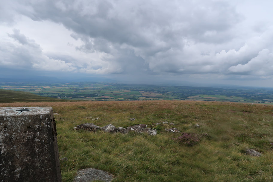
The path heads more or less to the large car park but my destination was to the right, so I made my way more directly in the direction I needed to go, picking up a very thin path which eventually petered out and left me with a short distance to walk on the road before leaving that for a double walled track which ran parallel to the road but was much more pleasant walking, leading eventually to the Maiden Way again. Up the slight incline and onto the road, I was back at the car a few minutes later.
Peaks climbed : Bink Moss (619m)
Total Distance : 7.2km, Total Ascent : 291m
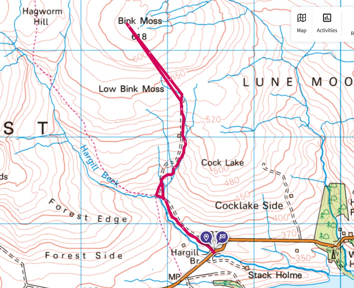
A very small parking space near the bridge on the road from Kirkby Stephen to Middleton was the starting point for the walk. It eases in gently with a nice track leading gently upwards. The track serves the grouse shooting on the hill so is wide enough for a 4-wheel drive vehicle. Eventually, though, I had to break off and head over rough ground with very little in the way of a path. The going would be described as soft in horse racing parlance and so I eased my way up winding my way around the various bogs and very marshy ground until I came up to the summit plateau.
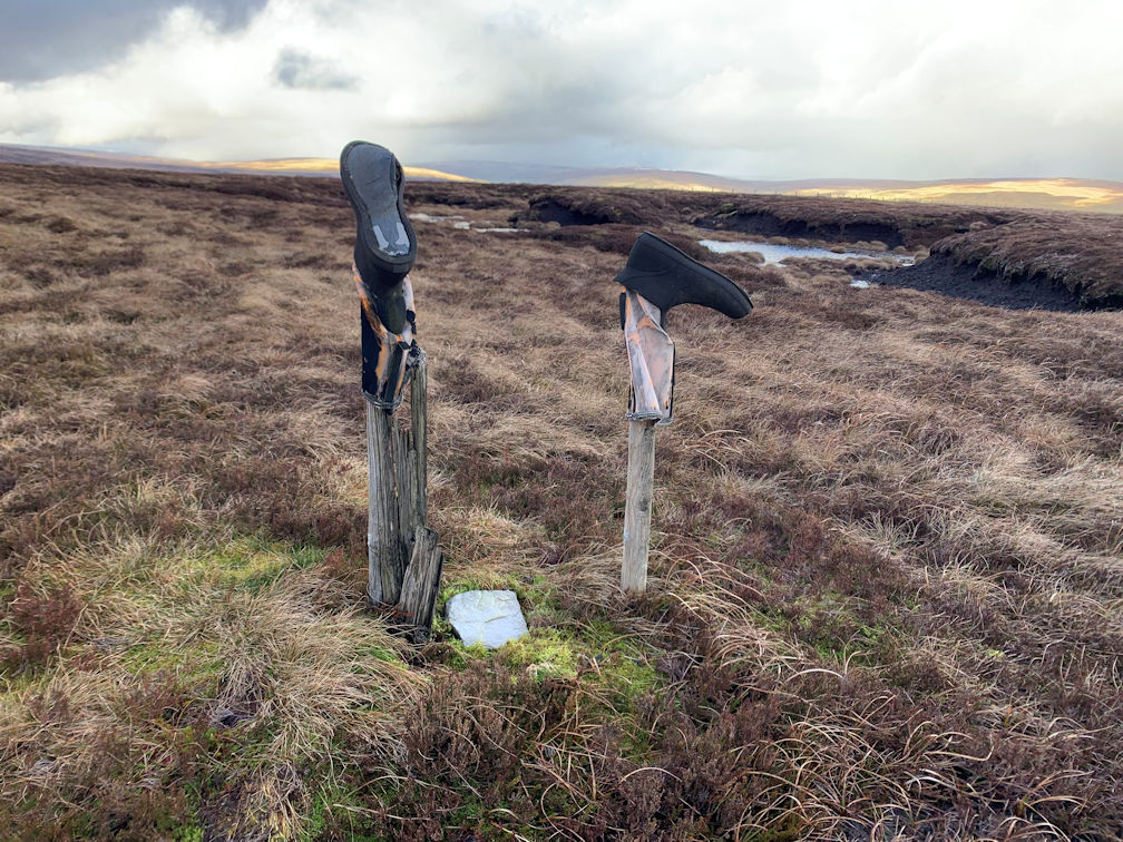
Bink Moss is one of those hills that has a summit but only by virtue of being a few inches, or centimetres in new money, above the surroundings. I followed the pointer on my map until it indicated I was at the high point. There is no trig point but there was what seemed to be a small summit indicator a few metres away so I headed over for a look. It turned out to be two sticks with inverted boots on them. I have never seen a summit marker like that, and may never again.
Due to the inclemency of the weather, being cold and quite breezy, I took a couple of photos and headed off to rejoin the good path. As always, the return seems further but I soon reached the track and headed down. It was around about this time that the heavens decided I'd had it too easy so down came the hail. That persisted for a while but then the temperature must have warmed slightly so the hail turned to rain. I was in one of those situations where I was close to the car, but far enough to get wet. I decided to press on rather than faff about with waterproof trousers. I was already wearing my waterproof top, more as a wind stopper than a waterproof but its role rapidly changed with the changing weather. I got back to the car and jumped in to wait for the shower to blow over which it soon did.
Another peak crossed off from this group of mountains. A few still to go and I'm glad to have got this one out of the way.
Peaks climbed : Dufton Pike (481m), Backstone Edge (699m), Meldon Hill (767m)
Total Distance : 25.5km, Total Ascent : 1,095m
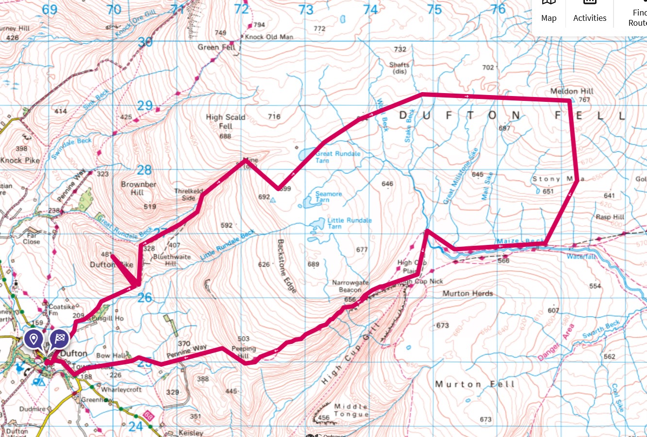
The small village of Dufton has, not surprisingly, a small car park, unfortunately full when I got there, but luckily there was parking in the main street. I donned my boots and gaiters, for which I have developed a new found affection - they keep my walking trousers clean and can be swilled off in a few minutes. Setting off, I headed back up the road a few minutes and was soon onto a small track heading in the direction of my first ascent: Dufton Pike.
Dufton Pike qualifies as a Marilyn rather than a Nuttall, but even so, did not disgrace itself. The ascent is a steep one from all sides. The preferred path is well marked, as are the 'no way up' paths. Fifty minutes after leaving Dufton, I arrived somewhat breathless on the summit and was rewarded with excellent views all around. Of course I didn't linger long as there was a big day ahead.
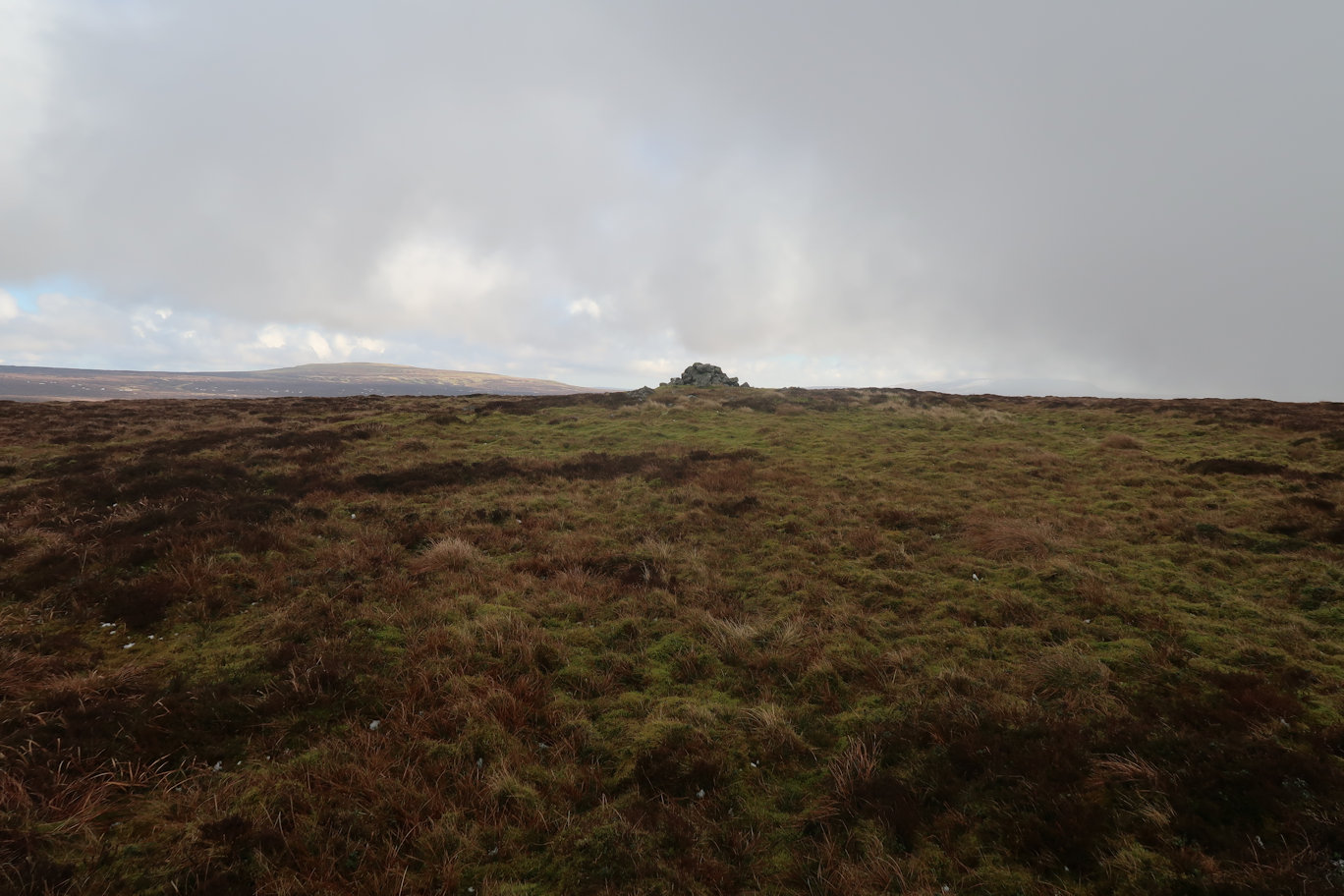
The best way off I decided was to retrace my steps back down to the track and follow that up through the old mine works. It is a good pull, never really steep, but relentless. Eventually I had to break off to the right and much more steeply upwards and onto Backstone Edge. The summit came quite quickly, but isn't the trig point which is some seven metres lower. I didn't stay longer than it took for a quick drink and a few photos as the hardest section was ahead of me. The walk over to Meldon Hill, which, already visible, was through terrain similar to Kinder Scout in the Peak District, i.e. peat groughs, streams, leg sapping heather and bogs waiting to catch the unwary. As I made my way across, if anything, it felt like it was getting harder, but perhaps that was my legs getting more tired. Eventually I could see the ground easing onto less heathery ground and I was pleased to reach it.
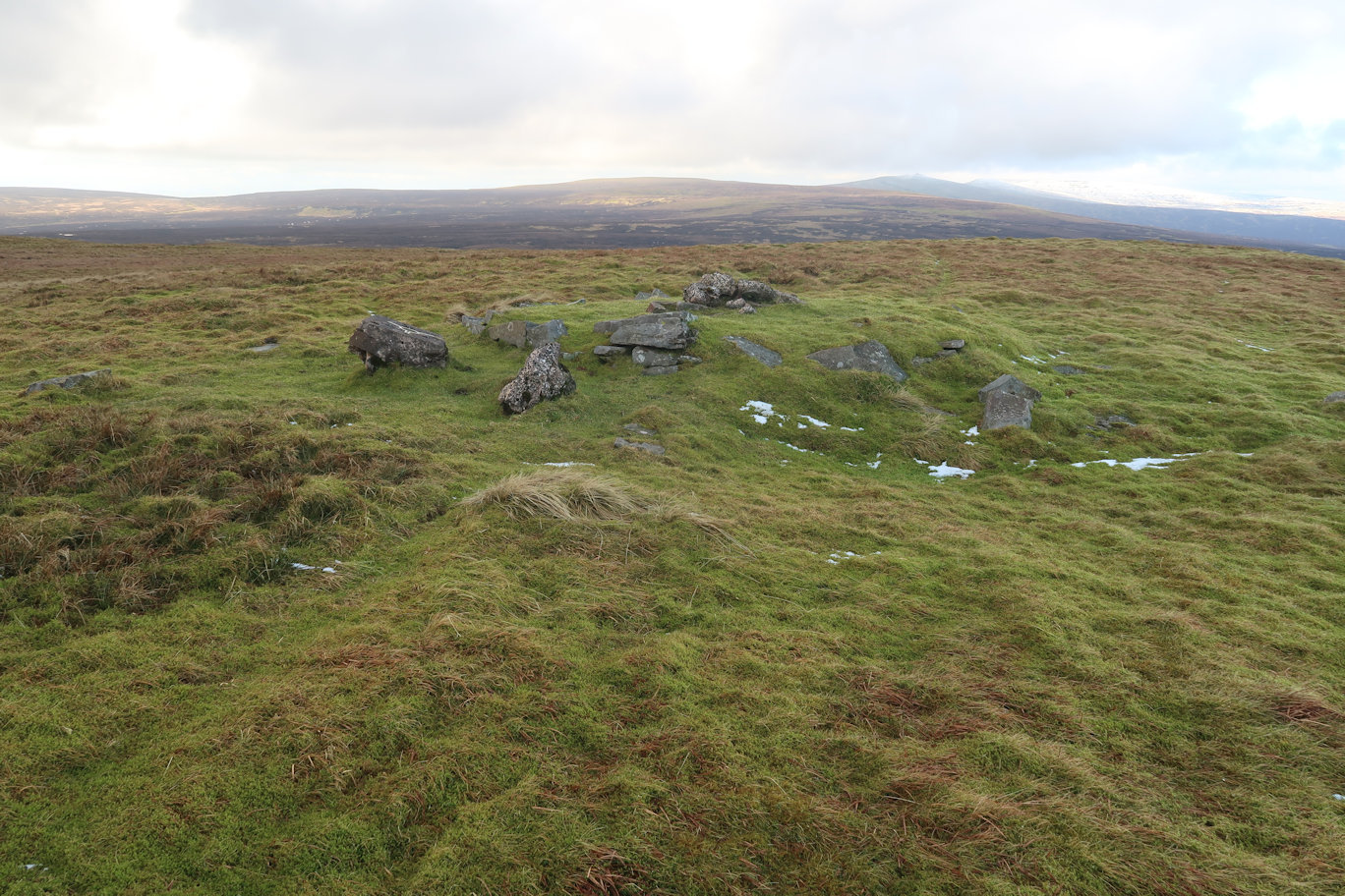
I'd convinced myself that the ridge line I could see was not the summit, and I was right, as I reached it, the hill went on to a second ridge, also not the summit, but I could see what looked like a summit cairn. Well, it kind of was, but not actually the summit. Meldon Hill has three outcrops, each of which looks like the highest. The first one I arrived at was, in my opinion, the highest point, but of course I had to visit the others. Walking over to the second and looking back, it was clear that the first one was higher than both the one I was at and also the third option. I walked back and spotted the wreckage of the trig point that had stood there at one point.
My plan was to head South to reach the Pennine Way path, not the most direct, but in this terrain, probably the best choice. In the end, my actual path was somewhere in between and eventually I came down to the Maize Beck which I would follow almost to High Cup Nick. The path I followed wasn't the Pennine Way, but it was a good path and led me in the right direction. My map showed a bridge over the beck and just as I thought it must have been demolished, there it was. I'd hoped to make the Nick for lunch but was so hungry I stopped on a nice rock by the bridge to eat my lunch. It was quite cold so I didn't stop long. As I got up to leave I decided to put on extra layers to keep out the cold and I was away.
High Cup Nick is the top of a huge glacial valley and an impressive sight. Not pausing longer than it took to take a few photos I headed down, following now the Pennine Way all the way down to Dufton. It was around four miles which was further than I'd thought it was, and in fact, the day was a couple of miles longer than I'd expected so I was well pleased to get back to Dufton and my car.
Another two Nuttalls ticked off, and mountains, to be fair, will almost certainly never be visited again by me so I was pleased to have got them done.
Peaks climbed : Murton Fell (675m), Long Fell (623m), Tinside Rigg (624m)
Total Distance : 23km, Total Ascent : 1,118m
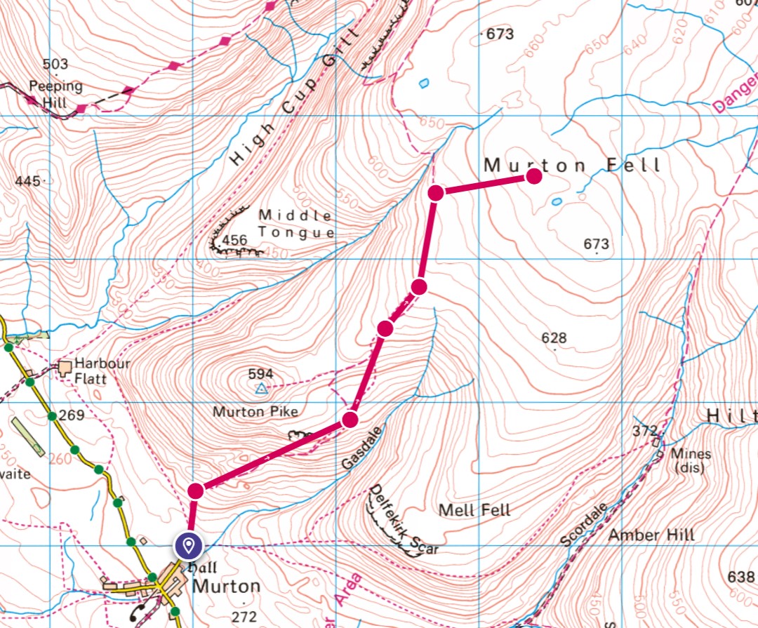
Murton has its very own car park at the base of the walks which is handy. I was there early but was still not the first to arrive. Boots on, I headed off in the direction of Murton Fell. It became clear very quickly that this would be a snowy walk, but there is a good track that lead up so I was happy. Eventually of course, I had to leave the path behind and strike out for the summit. Being snow covered, it was hard to read the terrain so I couldn't see any sheep or other tracks to help me. I was relying on my compass and map to give me direction - the cloud had descended to the point where it was a near white out. Occasionally there were breaks but not enough to help very much.
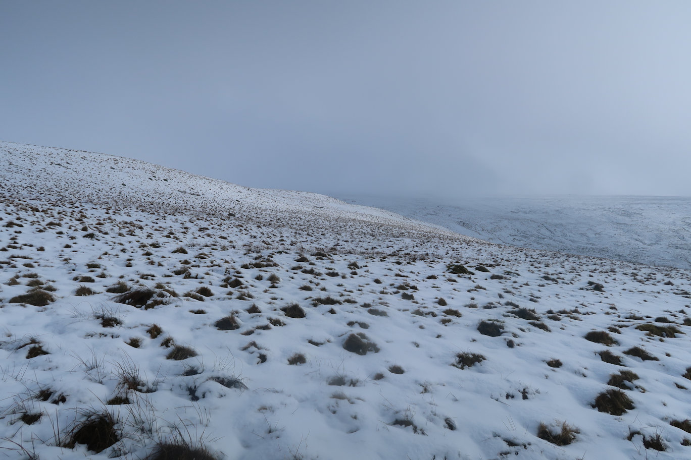
Taking as best a line as I could, I made my way in the general direction of the summit, from time to time weaving around obvious dips and possible ponds, although at one point my left foot sank up to my waist in snow and I felt it very wet. Clearly I'd broken through the snow to the water below! Eventually I arrived on the summit plateau. There is no definitive summit so I followed my map more closely and aimed for what seemed to be the highest point and claimed that as the top.
It was clear that today was not the day for a 2 1/2 km walk across to Little Fell so reluctantly I made my way back to the path, following my own footprints as being what I considered to be the safest way. Back down at the car, it was around mid-day. Too early to finish, so I had a drink and some food, changed into my dry boots and set off in the direction of what would have been the final two peaks of the day.
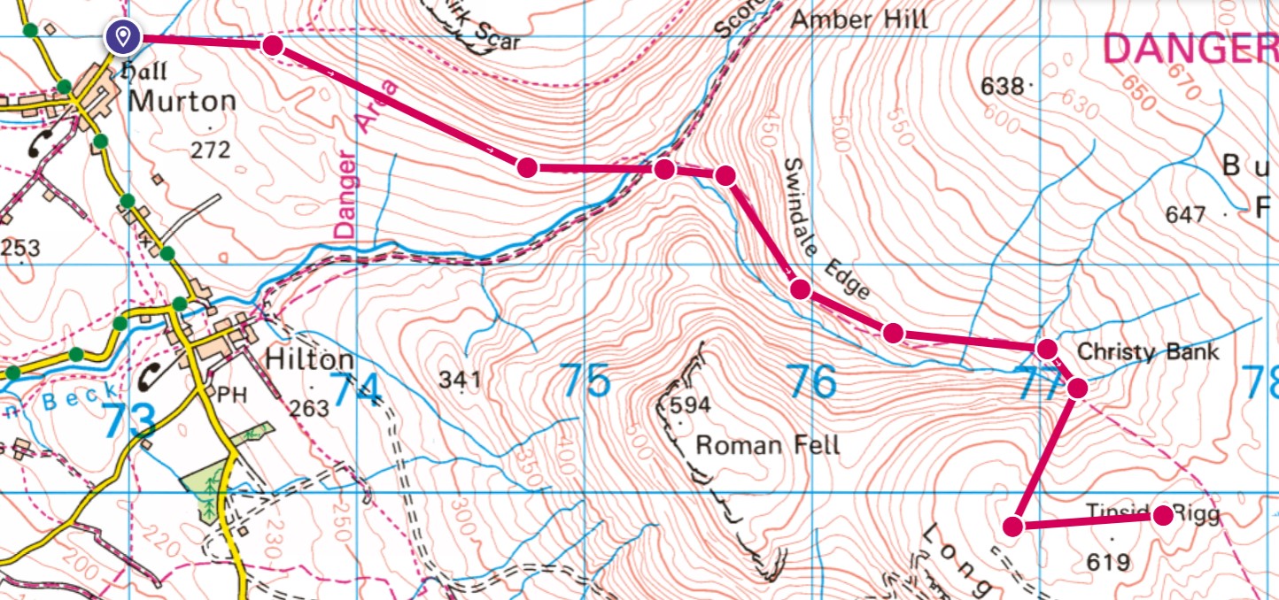
On the way up, following another good track, I stopped for some lunch and could see my route ahead - it looked very steep! The track continued for some time, but then narrowed to a path which, of course, was invisible due to the snow. Luckily there were posts placed at regular intervals which helped with general navigation. When I'd climbed as high as I thought reasonable on the path, I headed off for steeper ground and the summit of Long Fell. It was a good pull up on soft snow with frequent slides but eventually I made the ridge. Long Fell is another hill without a defined summit so again, I picked what looked like the highest point and declared it in my bag.
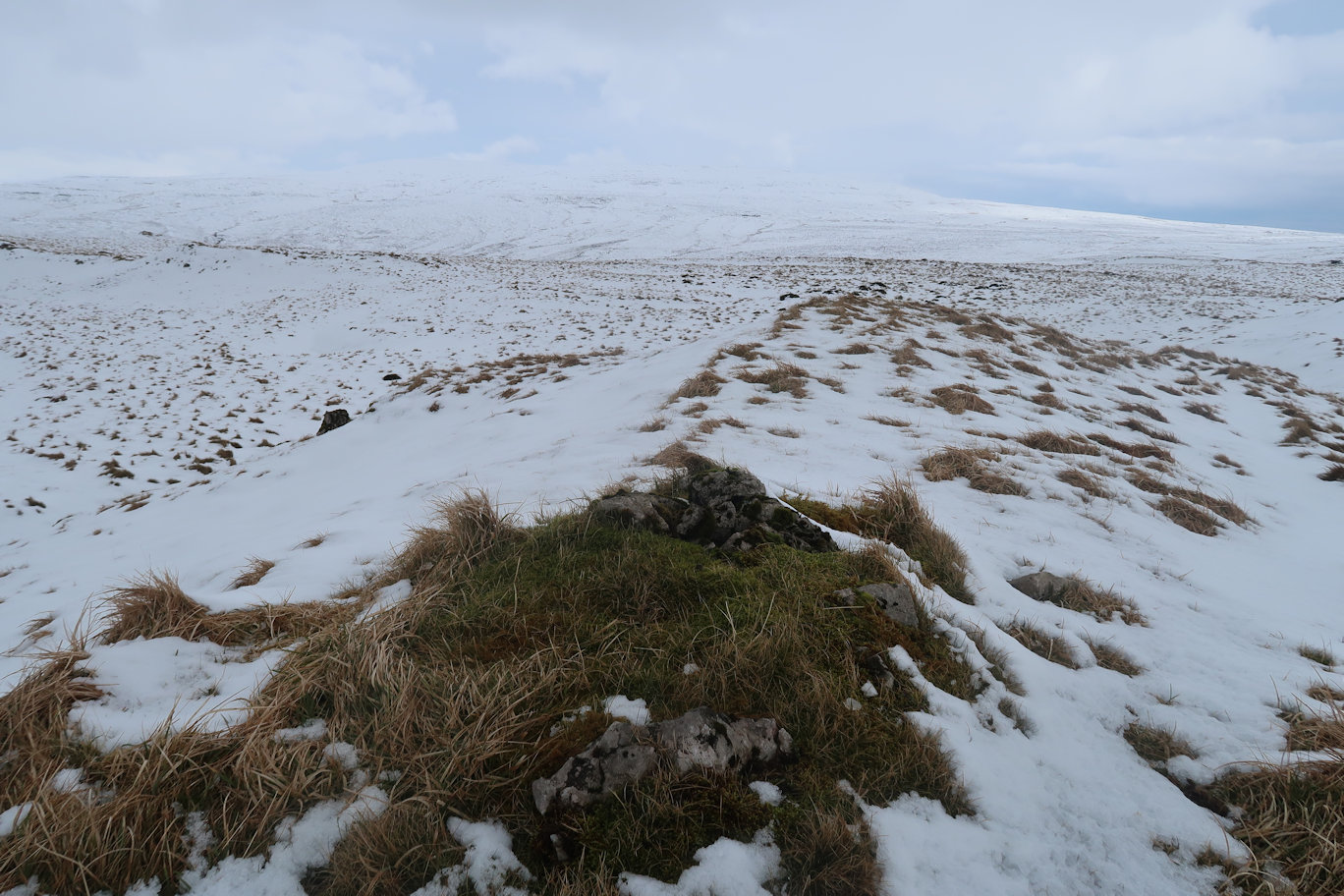
Tinside Rigg is an obvious summit a little way off so I took a direct line to it and was soon standing on my third summit of the day. Happy with that I headed directly across and picked up the path I'd followed up, walking down to my breakout point and onwards back to the car. I did stop a couple of times for food and drink. The length of the day combined with a very hard previous weeks mountaineering in Scotland had taken its toll and my body was telling me so!
Finally the car park came into view and I was very pleased to reach the end. Not quite the four peaks I'd planned, but a good three so happy with the days efforts.
Peaks climbed : Mickle Fell (788m)
Total Distance : 21km, Total Ascent : 868m
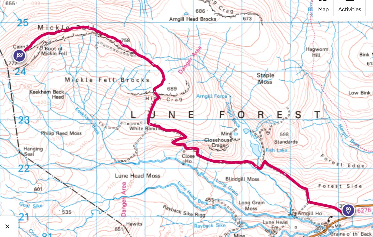
As I drove up to the parking spot, the road ahead was shrouded in mist, it looked like it was going to be one of those days - it was! I parked at the entrance to the long track that would take me most of the way up, located just off the B6276 about half way from Brough to Middleton in Teesdale. There isn't a lot of parking space, maybe three or four cars at most, but I was first there and figured, given the outlook for the day, would probably be the only one.
Kitting up, we were soon on the way up, Rosie enjoying herself running up and down and occasionally disappearing into the undergrowth on either side of the track. It is an easy track, wide enough for a vehicle and heads up at a gentle incline. There are a couple of points where height is gained quickly but they are short lived. Eventually, the track has to be left as the path heads through a gate and onto open countryside, although still on a good grassy path. This is followed all the way up to the trig point, which, whilst interesting, is a long way from the mountain summit.
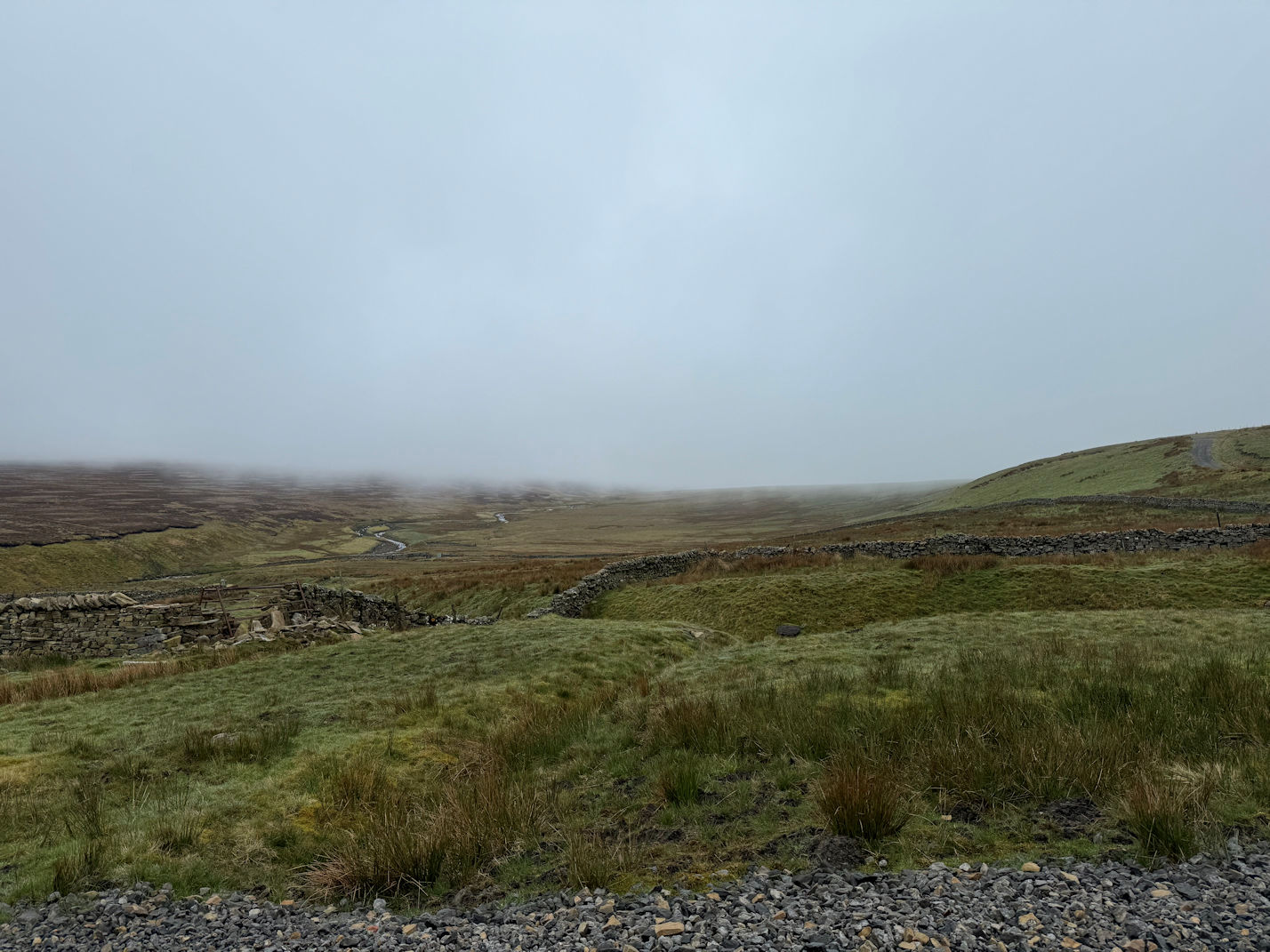
The mist was still low so there was no view, which made the walk somewhat tedious as there was no change of scenery but the going was good with very few bog detours. After the trig point, the gradient eases dramatically but it is some two kilometres until the actual summit which is something and nothing. I got to what looked like the high point, OS Locate gave the correct grid reference and the correct height, so I considered the mountain bagged and turned around. It was quite windy and I'd spied a large cairn on the way up so decided to walk back to that and use it as a windbreak for a stop.
Sat there, I was surprised to be greeted by two other walkers and then a minute or two later by another. The first pair were climbing 'Hewitts' and the second 'County Tops'. Not only does Mickle Fell qualify for both categories, it is a Marilyn and a Nuttall so caters for all collectors. We discussed the location of the actual summit, I claimed it was back a way but the others claimed it was this cairn. Clearly it isn't as it is noticeably lower than where I had come from, it wasn't within the grid reference range nor where Nuttalls have their marker point. Not to worry, I had been to both locations and my fellow walkers were happy with their bags so all good.
The return journey was without incident and after a short lunch break on the way down I was soon at the car. The penultimate Nuttall in the Cross Fell group done and another to tick off on the Marilyns list.
Peaks climbed : Little Fell (745m)
Total Distance : 14km, Total Ascent : 700m
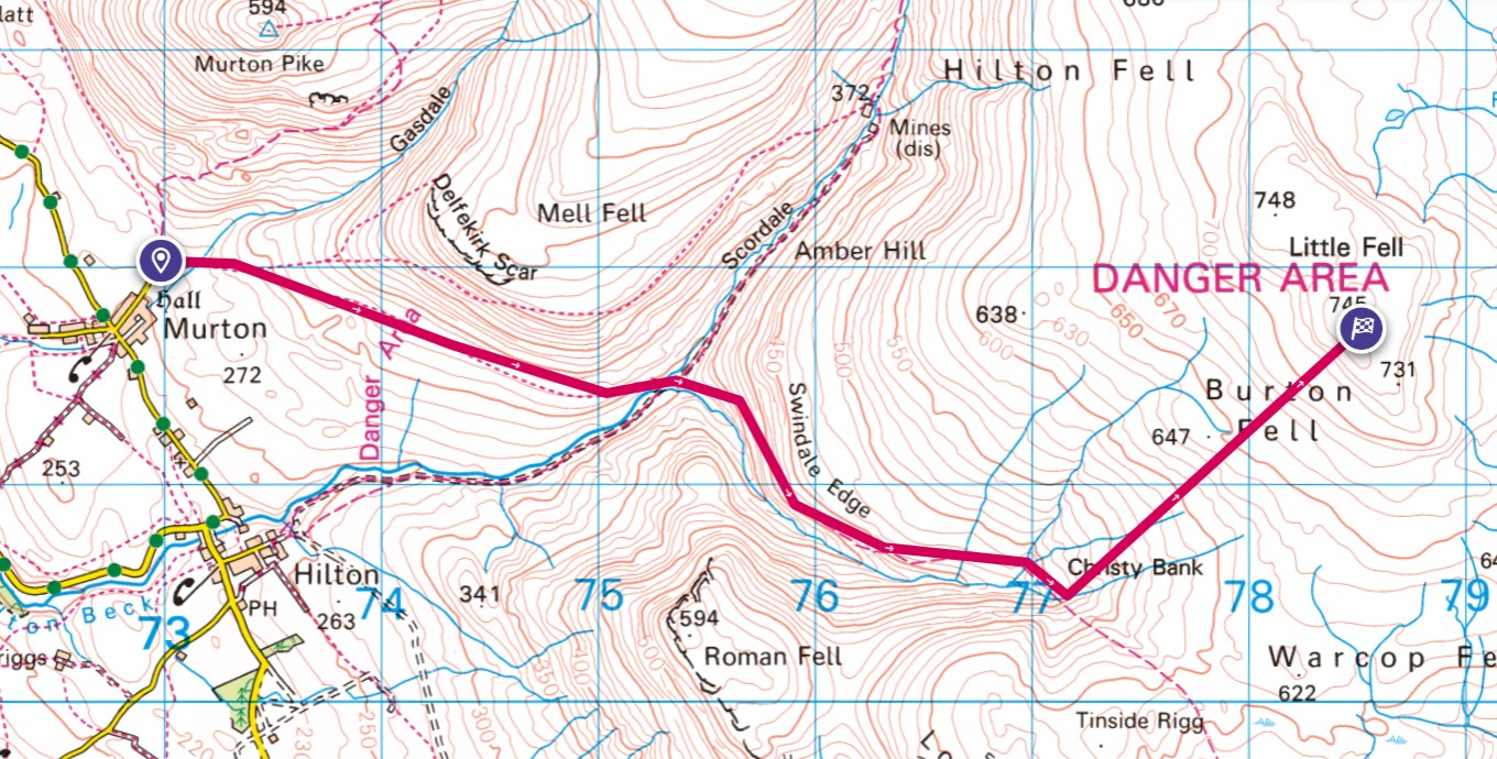
As with the last time I came up to these mountains, I parked in the Murton car park and headed off over gently sloping ground to the beck, which signalled the start of the climb up. There is a reasonably good path that slants upwards gaining well over one hundred metres in a relatively short space of time. As it flattened out I turned left and headed up over pathless terrain. Also, the cloud base was around 1,000 feet so visibility was non-existent, but I knew that if I headed up roughly South-East I would come to the summit plateau.
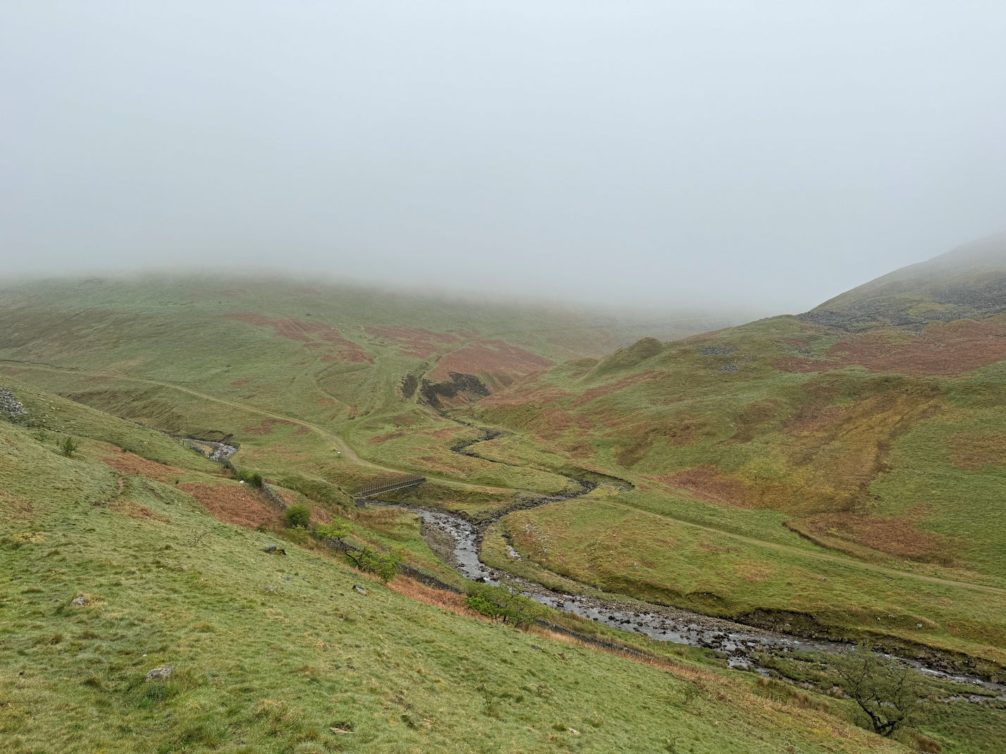
With such poor visibility it seemed to take forever but eventually my altimeter showed me at just under 700 metres. I knew it was reading low so was on the last section but there was a sting in the tail as the mountain reared up for one last big ramp up to the summit ridge. I still could not see the actual summit so headed in what I considered was the right direction to gain altitude, spying in the mist, what looked like a large shelter and exactly where I was expecting the trig point to be. Turns out, it is, but the trig point has collapsed and the shelter surrounds it.
I didn't stay long as it was a little chilly and there was no view, so attempted, and largely succeeded in retracing my steps down to the path, turned right and followed it down to the bridge over the beck. As I had not really stopped all morning, I elected to stop for a drink and goodie bar before heading off and following the path over the farmland and back to the car. This was the final peak in the Cross Fell area and in fact, the final peak in the whole of this area.

