| Malvern to Ledbury | |
|---|---|
| Map | Distance |
| Explorer 190 | 10m |
| Malvern to Tewkesbury | |
| Map | Distance |
| Explorer 150 | 24m |
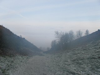
The Malvern Hills have been made famous for many reasons; Edward Elgar took inspiration, the spring water is bottled and sold to amongst others, The Queen and there is no higher land mass going East until one reaches the Ural Mountains in Russia. A walk on the hills can be an excellent way to spend the day and so it was that a on a cold crisp December morning at the end of 2012 I found myself heading up from Malvern to North Hill; the hill at the Northern most end of the range.
Navigation on the hills is pretty straightforward - the hills run due North-South with Malvern on the Eastern side.

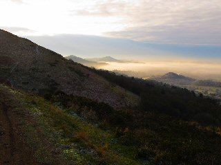
Heading up past the old quarry and the clock tower one soon gains altitude and there are some excellent views towards Worcester behind. Onward and upward to one of the many paths that follow contours around the hills, straight across through the saddle the summit of North Hill is a short climb to the left and one that begs to be bagged. At an altitude of 397m it is one of the highest. Sadly to reach the Worcestershire Beacon some of the well earned altitude has to be sacrificed but the damage can be limited by skirting the right (Western) side of Sugar Loaf, the next hill along. Reaching the direction marker it is then a steady climb to the summit of the Beacon and the highest point on the range at 425m. It is sad to think that the cafe that used to be here is no more - it was a welcome refuge from the biting wind that often blows across these hills due to its elevation and position. Nothing for it but to press on and down the hill, either following the road that was built to service the cafe or nicer still on the grass to its left or right, finally arriving at the Wyche Cutting. Take a left here to the Wyche Inn and a welcome break or press on and up again to the small woodland near the summit of Perseverance Hill.
Following the ridge line and being careful to avoid straying to the left where there are steep sided quarries one eventually arrives at the 'British Camp'. There is a hotel and bar plus a small cafe open in the summer time for refreshments. Also there is a large car park but for those on the full walk to Ledbury it serves as a short break only before tackling the impressive Camp itself standing at 338m.
The information on the wall explains that there has been habitation here for many hundreds of years and as you walk up it is hard to believe that such a construction could possibly be man-made, but man-made indeed it was and a testament to the vision and determination of those ancient Britons who constructed it.
Over the top and down the other side one gains a glimpse of the Obelisk in Eastnor Park - a guide point on the walk. Walking down one passes the Giants Cave, although the giant would not have been that big - the cave is barely 2.5m high. Down further, then up again to Hangmans Hill and take a right before reaching Gullet Quarry, then at the bottom of the hill take a left and follow this (normally muddy) path to the entrance to Eastnor Park, part of the Eastnor Estate. Walking up one quickly reaches the Obelisk, erected in memory of members of the Somers family who died in various military conflicts over the Victorian years. Down again and into the main park where you might be lucky enough to see some of the wild deer that live here. Curve South, over the lakes - there is a path through the middle of the two and head to the corner and the exit onto the main Ledbury road.

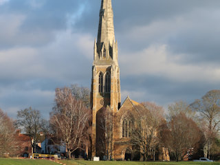
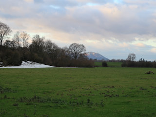
Go through Eastnor village, skirting past the small village school and pick up the path a hundred metres or so on the left hand side by the house entrance next to the church. This will take you out onto a big field where the path heads up the hill through the middle of the field and down to other side into the woods.
It is a steady walk here through the woods and a couple of fields until the final stretch through Conigree Woods and down into Ledbury. Turn left at the end will bring you to the Police Station.
From here, turn right immediately past the station and into the church yard. A left takes you down a cobbled street past several cafes, one of which will be irresistible of course! Finally emerging onto the main High Street, the railway station is to the right just outside the town past the supermarket and petrol station. Trains from here run regularly in the direction of Hereford and Birmingham via Malvern, so if you have left your car at one of the Malvern Stations, it is a short fifteen minutes or so to bring you back to your starting point.
This walk can be done at any time of the year in either direction, taking around 4-5 hours at a steady pace with about ten miles covered. There are numerous maps of the Malverns from the standard OS 2cm to 1km right up to six inches to the mile if more detail is required.
I had been toying with the idea of a walk from Malvern to Tewkesbury for some while. I was pretty sure it was achievable with the minimum of road walking and taking in as much of the Malvern Hills as possible.
There is a convenient train leaving Tewkesbury at 07:36 direct to Malvern Link, arriving just after 08:00am - perfect.
Leaving the station I headed up towards the imposing North Hill and my first challenge. There are several routes to the top but I decided on the direct route from the clock tower up past the quarry. There was still a good deal of snow around, plus a lot of ice, so care was needed to avoid slips. Approaching the summit, the wind picked up but luckily it was a Northerly wind so at my back. From North Hill, there is a drop down and over Sugar Loaf and then another good climb up to the Malvern, or Worcestershire Beacon which was also, not surprisingly, quite windy. It was a clear day and the views were amazing. Hay Bluff in the Black Mountains was clearly visible, as was Pen-y-Fan in the Brecons.
I dropped down a little and sought shelter for a quick break and some warming hot blackcurrant juice. Soon off I dropped down to the Wyche Cutting and then up again, following the ridge line until I arrived at the British Camp Hotel. Decision time - my route lay down to the reservoir and onto Welland Common, but the Herefordshire Beacon called me. Me being me, of course I had to climb so set off upwards. The first section did make me wonder about the decision as it was incredibly icy and slippery, requiring the use of the handrail to make progress.
Soon enough I was on easier ground and made short work of the ascent. Off down the South side, I turned towards the reservoir and made my way down to re-join my original path which I followed downwards and onto Welland Common.
This section was the only section I had concerns about. I knew I could walk through Welland and out towards Malvern where I would pick up a path to Hook Bank, but after that, I wasn't really sure. The alternative was to head to the Eastern side and hope for a path through to the Upton Road. I chose the latter and was rewarded with a footpath sign which showed great promise until I hit a new housing development! Picking my way around I emerged onto the road much earlier than I had hoped. Oh well, nothing for it but to walk down to the New Inn. After a few minutes I spotted another footpath sign which would have probably taken me around the housing development and avoided some road work. Too late!
From the New Inn, there was a bit more road up to Brotheridge Green where I hoped to get onto the old railway line which would take me all the way into Upton. Now I knew the first section was not a designated path but hoped I might make some progress. Dropping down under the bridge, my way was immediately blocked so back up again and over the road to follow the alternative path. Again another false start, the path started swinging in the direction of Hook Bank which is where I had come from, so back again. Nothing for it but to walk down the road and hope for something better.

A few minutes later I spotted a footpath sign heading back to the railway line, so followed it. The path actually just crossed the line but I decided to give it a try and followed the route of the railway. This worked reasonably well and I fancied I was on a proper footpath, but a few minutes later it came to an end. Negotiating the small stream over a convenient felled tree I finally got back up onto the escarpment that was the railway line and made some more progress, although clearly not a footpath, I made progress in the right direction until, once again, came to a halt and had to cross a field to the road.
Another short road section followed by another path bought me onto the railway line again and some good walking until, yet again, a dead stop. This time I had to retrace my steps some way until I could get into a field and back to the road which I then followed until a third path took me back to the railway line. I knew this section and knew I could now stay on the railway line all the way to Upton which I did.
Lunch was had on the rugby pitch. I had covered 17 miles and reckoned on another 7-8 miles which was further than I had originally imagined, but it was only just after 1pm so I had a good three hours before dark and an entirely flat walk along the river - easy!
Setting off, I by-passed Upton and picked up the river about a mile and a half downstream. In the distance I could see the M50 which was about half way from my current position to Tewkesbury so provided a good motivation. What could possibly go wrong?
I found out! A huge tree had fallen across the path. On the one side was the river, on the other a pond surrounded by a fence. Nothing else for it, off came the rucsac and I pushed it through, followed by my walking poles. I then shimmied, wriggled and twisted my way through, muscles already tired from walking complaining bitterly. Finally I emerged reasonably unscathed, picked up my gear and headed off, hoping for no repeats.

I had one more stop for a goodie bar and drain the remains of my still warm blackcurrant juice before I made the final push to Tewkesbury. Tired, I crossed the Mythe Bridge and walked into town, promising myself a coffee and cake at the first place I saw - which I knew would be the 'Costa'. Disaster! There had been a burst water main and all the coffee shops were closed! Dejected, I decided I needed to man-up and make the final mile or so home across the fields. Arriving at the door I thankfully took off my boots and walked in too discover water had returned so could make my own coffee.
The total mileage ended up being 24.5 which was somewhat further than I had thought it would be, but I had done it with a total walking time of just over 8 hours which averaged out at 3mph which I was pleased with, given the first section was over the Malvern Hills.
I'm intending to do it again sometime, but I want to investigate the paths between Welland and Upton, I feel there is a route that avoids roads altogether, I just need to find it.

